QY-BT
Intelligent Bathymetric Mapping


Elevated Precision, Efficiency,
Convenience and Safety
One-Stop Solution for Underwater Mapping

Intelligent Path Planning
Powered by QYSEA's proprietary Q-DVL sensor and underwater inertial navigation system, QY-BT enables path planning for auto cruising, defines terrain scanning routes for the desired operational area, and efficiently collects spatial terrain data with speed and ease.

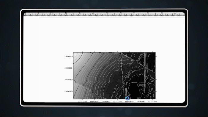
Depth Colour & Contour Line Display
QY-BT supports importing spatial terrain data into its software tools to generate 2D terrain maps. Users can customize depth color codes and contour line details to suit specific operational needs.

Customizable 2D & 3D Terrain Maps
QY-BT supports importing spatial terrain data into its software tools to generate 2D terrain maps. Users can customize depth colour codes and contour line details to suit specific operational needs.
2D Terrain Map

3D Terrain Map

Multidimensional Combined Terrain Map

One-Click Calculation
QY-BT integrates collected spatial terrain data with advanced algorithms to calculate water volume, net capacity, and area with a single click.